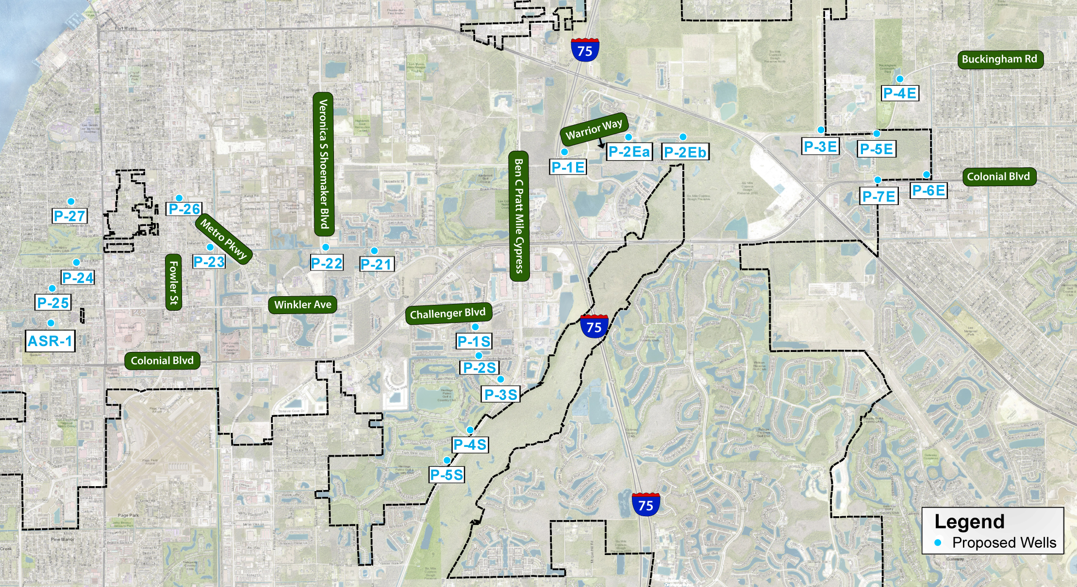
Proposed Well Location Map


Raw Well P-22 & P-21
In September 2021, the City began construction on the first two raw water wells identified as P-21 and P-22. These wells are expected to be in production by summer 2022. Well locations along with their associated new transmission main pipeline are shown on the aerial map below. Click here for more P-22 & P-21 construction information.
P-22 & P-21 Location Map

Portions of the North Colonial Linear Trail between Veronica S. Shoemaker Boulevard and Hodges University will be closed during the well drilling and transmission main installation operations. More information to come.
Raw Well P-1S & P-2S
In January 2022, the City will begin construction on the raw water wells identified as P-1S and P-2S. These wells are expected to be in production by fall 2022. Well locations along with their associated new transmission main pipeline are shown on the aerial map below. Click here for more P-1S & P-2S construction information.
P-22 & P-21 Location Map

Portions of the Winkler Avenue East sidewalk between Queen Palm Lane and Glenford Boulevard will be closed during the well drilling and transmission main installation operations.
![]()